Social Studies
Click work samples and files to open them.
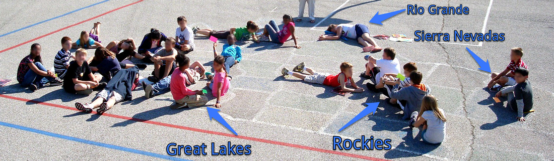
Whenever possible, I like to get students moving. While studying both land forms and US states, I took the class outside and gave them index cards with a US land form on each one. Students had to remember where the land form was and then recreate it with their bodies on a large map that was painted on the playground. I have highlighted a few of the locations.
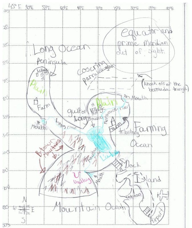
Students can retain information better if they approach it from different perspectives. During our study of land forms and latitude/longitude, it was clear that some students had trouble remembering what each was. I assigned them to create their own island, incorporating a certain number of features. Beyond that, their imaginations and creativity took over.
The rubric for this map is available on the second assessments page of my portfolio.
The rubric for this map is available on the second assessments page of my portfolio.
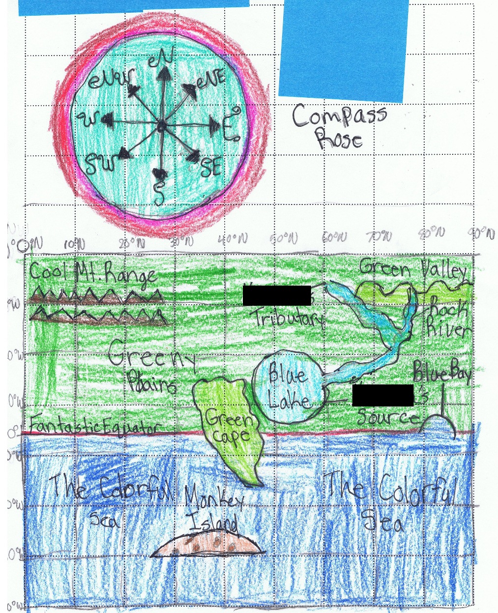
This is another student's map. This student did not like the grade he or she earned and decided to revise the map to incorporate my suggestions (I like to include a narrative evaluation along with scores).
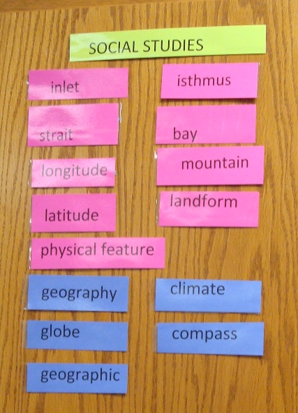
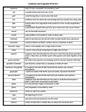
My cooperating teacher kept vocabulary, sorted by content area, visible in the classroom. This is a practice I intend to copy in my own classroom.

In order to practice for various land form, latitude/longitude, and US states and capitals assessments, I created a Jeopardy-type game for the students to play. They played in teams and could move around the room while looking for answers.
I used a template I found on the internet with no rights restrictions.
(Click to open PowerPoint file--feel free to use for your own game!)
I used a template I found on the internet with no rights restrictions.
(Click to open PowerPoint file--feel free to use for your own game!)
Students in my placement were accustomed to working with vocabulary sorts to practice. In keeping with that, I created a land forms vocabulary sort. Note that they are out of order to begin with in order to force students to actually cut them apart and then use them.
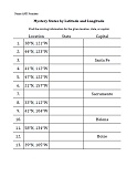
All the fifth grade students were studying longitude and latitude at my placement school. The practice worksheets that came with the social studies book were not enough practice for many of those students. I created a practice worksheet for the entire grade with a key. This worksheet covers the western states, since fifth graders were also learning the western states and capitals at the time.
It should be obvious from the artifacts I have posted here that worksheets are not my primary method of helping students practice. But when they are used as part of a variety of methods I have found that they can be effective. The trouble is relying on them as the only method of practice. No one method of practice will serve all students, which is why I feel it is important to maintain a variety of different practice activities.
It should be obvious from the artifacts I have posted here that worksheets are not my primary method of helping students practice. But when they are used as part of a variety of methods I have found that they can be effective. The trouble is relying on them as the only method of practice. No one method of practice will serve all students, which is why I feel it is important to maintain a variety of different practice activities.
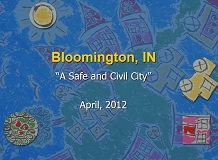
While working a long-term subbing position, my third grade class had to study a chapter in their textbook on cities. The book went into detail on various jobs in city government. Unfortunately, those jobs did not entirely match with the city in which we lived.
I created this presentation to go along with our textbook reading so that I could give them visuals of our local politicians and point out differences between the book and our city.
I created this presentation to go along with our textbook reading so that I could give them visuals of our local politicians and point out differences between the book and our city.
